Siskiyou County, California
Throughout this region numerous mining operations were actively conducting both underground and surface mining projects that were prolific gold producers that were largely mined until WWII shut down production.
Having remained predominantly idle for the better part of a century, this region offers the opportunity for further development of high grade gold mines where there has been very limited modern day exploration and development drilling from surface and underground.
The Salmon River region is an excellent source for finding lots of high-grade gold.
If you're in the market for owning a great gold property, there is no place on Earth where you will find anything quite like this region. Two of the most successful mining clubs in the U.S. have concentrated their efforts in this area... This in itself speaks loudly of this regions' richness.
This is a place with excellent potential for getting gold in your riffles every time... where the history of California's gold rush still lives on... where prospectors young and old can experience the thrill of finding gold in one of the richest gold mining regions in America.
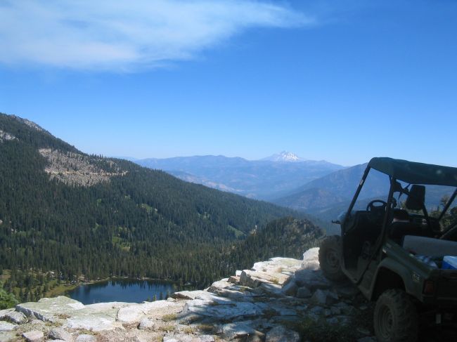
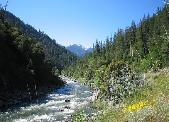
The Salmon River
Along every mile of the Salmon River in Siskiyou County placer gold is found. Almost every type of placer mining has been used on the river. Both the north and south forks were productive and one stretch between Forks of Salmon and Sawyers Bar is estimated to have produced 2M ounces of gold. Also known as; "The richest little river in America", this is one of the richest rivers in Siskiyou County.
The North Fork Of The Salmon River aka: "The Richest Little River In America"
1925 California State Mineralogist’s report states that from Sawyers Bar (Eddy Gulch) to The Forks of Salmon (12 mi. downriver) produced 2M ounces of gold.
Sawyers Bar
Sawyers Bar is located in the Salmon River district and contains roughly 800 square miles of extremely mountainous country between the Marble Mountains and Salmon and Trinity Wilderness areas. This area had a total production between 1855-1965 estimated at 16,000 ounces of placer gold and 20,000 ounces of lode gold. In all regional stream gravels you can find placer gold and platinum. There were very many huge hydraulic operations and Chinese diggings, accessible from the east on Sawyers Bar road. The North Fork of the Salmon River in all gravel and slope wash deposits you will find placer gold.
Trail Creek
Salmon River mining district, 12 miles west of Callahan in the Klamath Reserve. Elevation of 7200 feet, reached by trail from Callahan. The fissure vein occurs between schist walls, with a strike of N. 40' W., and a dip of 60' N.; ore shoot is 300 feet long and 2 feet wide; workings consist of an 850-foot tunnel, several small drifts and a stope 200 feet in length; equipment consists of two 3 1/2-foot Huntington mills (capacity is 20 tons in twenty-four hours, through 50-mesh screen) run by waterpower; tools, ore cars and dwellings; seven men are employed; owner claims an ore reserve of 3000 tons of rock; free milling; yearly production 1912 (seventy days' run) was $15,000; production to date $40,000: best prospect in the district.
The Uncle Sam Mine
Liberty Mining District. with documented production of 4,000 oz's. between the years 1860 to 1905.
The Union Mine
Liberty Mining District. Estimated gold production at 20,000 ounces pre-WWI.
The Whites Gulch Mine
A hydraulic operation worked until 1970 for its placer gold. The gravels of South Russian River have rich placer gold and platinum deposits on bedrock. Many mines on the North Fork of the Salmon that were substantial producers.
Whites Gulch
Liberty Mining District. In 1860, an outcropping of gold bearing quartz was discovered in Whites Gulch by four men. Soon after the discovery, a claim was laid out and a mill was purchased in San Francisco and moved to the discovery location, "much gold was taken out". Charles Nash and another party of prospectors traveled up nearby Eddy Gulch and discovered gold bearing quartz veins breaking through the surface of the ground. This resulted in the delivery of a second quartz mill to the area. The mill for the Live Yankee Mine was brought up Eddy Gulch to what is now called the Live Yankee Gulch, at the head of Eddy Gulch.
The Yellow Jacket Mine
Liberty Mining District. Contained three parallel veins, each running north and south. The majority of the mines in the area worked in a primitive black slate formation which is further explained in multiple geology reports. This formation is almost identical to the major gold deposit found in the Sierra Nevada range, both having considerable bearing veins running to depths and lengths for miles.
Source - California State Mining Bureau.
Report XIV of the State Mineralogist (1916).
The Black Bear Mine
Producer of approximately 200,000 ounces of lode gold.
The most notarized and richest lode mine in Siskiyou County. Liberty Mining District. Producer of approximately 200,000 ounces of lode gold. The deposit at the Black Bear Mine was discovered in 1860 and consisted of two incredibly rich veins, one running north and south, and the other vein ran east to west. The Black Bear Mine has a very documented recovery history with receipts of bullion being shipped to the Selby Smelting Works or to the US Mint in San Francisco. Many area mines in regional canyons produced lode gold. At the location of the East fork of the South Fork of the Salmon River, placer gold and platinum nuggets have been found.
Eddy Gulch
The Eddy Gulch Placers
In the 1850s, recorded production for the placer mines in Eddy Gulch was 150,000 ounces Au.
Located in the Liberty Mining District. This district contains many high-grade lodes. Examples of data from California State Mineralogist’s reports and numerous private geologic reports state approximate gold production for Eddy Gulch was 150,000 oz. in the 1850's. It is reported today that a group of properties in this area that are known as; The Eddy Gulch Group, have an estimated 900,000 ounces in gold reserves.
The Forks Of Salmon
The Forks of the Salmon was the center of large gold mining operations and all regional stream and bench gravels had very rich placers. There were huge hydraulic operations on the major streams which produced thousands of ounces of placer gold.
The Highland
Known also as the Old Highland. In Sec. 12, T 39 N., R. 10 W., in the Salmon River mining district, 12 1/2 miles northwest of Callahan in the Klamath Reserve. Fissure vein between walls of granite and schist, being an extension of the Trail Creek ledge; 200-foot tunnel, and 400 feet of drifts; ore is free and easily worked; idle at present; Trail Creek prospect to the south. Bibl.: Report XIII, p. 405.
The Jumbo Mine
Liberty Mining District. Between the years 1927 – 1935 the Jumbo Mine was reporting an average of 1 OPT.
The Keaton & Cleaver Mines
Liberty Mining District. Between the years 1927 – 1935 the Keaton and Cleaver Mines reported an average of 1/4 OPT.
The Hickey Mine
Liberty Mining District. Between the years 1927 – 1933 the Hickey Mine was reporting up to 1.5 OPT.
The Homestake
in the Klamath Reserve. Comprises 120 acres on the same lode as the Highland mine; formation is quartz-porphyry and dioritic schist; worked by means of tunnels; high grade (pocket) gold extracted, which has made the property noted; discovered in 1902; elevation is 6100 feet; has produced several thousand dollars in high grade; 2-mile trail from wagon road.
The Klamath Mine
Liberty Mining District. Recorded production of 35,000 ounces between the years 1863-1910.
The Lanky Bob Mine
Liberty Mining District. Estimated production of 3,000 ounces between the years 1927 to 1933.
Liberty District
The Liberty district is about 10 miles east of Forks of Salmon. The placers were discovered here in the 1850's. The area was active until the start of World War II and some prospecting has taken place since. Many lode mines in the area.
Liberty Mining District. Recorded production of 36,000 ounces between the years 1863-1910.
Immediate Area Gold Production History
The following is a tiny snapshot of some of the gold production history within the immediate area of the gold properties we offer for sale in this region.
Situated in the middle of 3 major wilderness areas...
Separated from the Redwoods only by the coastal range...
Vast beauty, Lesser-traveled, Adventure, Excitement...
Extreme Northern California's Gold Rich Salmon River Region
It's a wild place to explore


Siskiyou County, California
Siskiyou County contained more than 370 once active gold mines which yielded approximately 1,800,000 troy ounces of gold between 1880-1959, with a large unrecorded amount produced between 1850 and 1880, which may have amounted to another 1-2M ounces.
Compared to other California counties, little has been officially reported regarding gold production, and what has been recorded, equates to billions at today's gold prices.
Gold is not the only metal of importance in Siskiyou County. The county is said to contain large platinum group metal deposits as well. This is a region that offers enormous opportunity for further mines development and exploration potential.
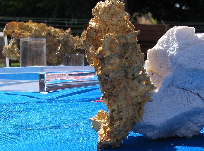
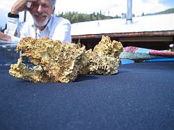
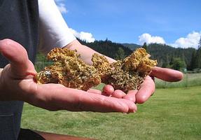
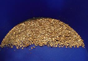
Pocket Gold Specimens
The Claim Post... representing the finest in gold property listings.
High-grade gold mining properties for sale.
Liberty & Salmon River Mining Districts. Siskiyou County, CA
We are a small independent company with more than 40-years experience in the gold mining industry who have predominantly focused our attention and gold recovery labors in this region.
While taking in to account what has been documented by state and federal agencies, historians, geologists, scientists, & by way of our own experience, we believe this area represents an incredible opportunity for recovering mass quantities of gold within proven gold producing trends that boast phenomenal records of gold production history.
We invite you to consider the few mining properties we are offering for sale in this region.
Contact Us!
T: 303-827-3311
The Claim Post. High Grade Gold Properties For Sale. © Copyright 2003 to present. All rights reserved.

The richness of this region and the gold recovered is documented in multiple County, State, and Federal reports and documents. Many leading geologists confirm that the gold bearing trend in this district extends for miles and to unknown depths. Mining operations of the past merely dented the surface.
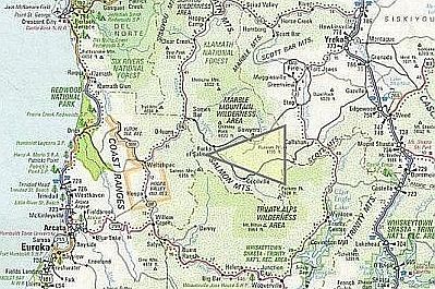
Historically rich in sources of gold, this triangular group of mountains is most likely responsible for the largest part of the placer gold that we find in the Salmon Rivers.
The sources of the placer gold that is found in the North & South Fork Rivers most likely comes from a series of lode deposits that strike across the head of this mountainous region.
Gold Mining Properties
In one of the richest gold mining regions in the United States
the most trusted name in gold property listings.
The Claim Post
est. 2003
World-Class gold properties for sale